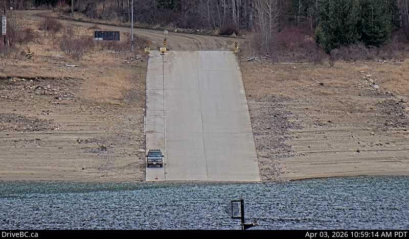
Area K South Live Webcam
Experience the stunning views and real-time traffic conditions with the Area K South live webcam, located on Highway 6 in Burton at Burton Main Road. Situated about 22 km north of Fauquier, British Columbia, this live feed provides a clear look south along this scenic route, helping travelers and locals stay informed and connected.
Why Check the Area K South Webcam?
- Real-time Traffic Updates: Stay ahead of traffic delays or road closures on Highway 6.
- Weather Monitoring: Prepare for changing weather conditions by viewing current live images.
- Travel Planning: Ideal for planning your journey through this picturesque region of British Columbia.
Nearby Live Webcams to Explore
Expand your view of the region by exploring nearby webcams such as the Area K North: Highway 6 at South Arrow Park Ferry Terminal, offering views of the north landing at Upper and Lower Arrow Lakes. For a broader perspective of the Vancouver area, check out the Vancouver South: Knight Street Bridge – Mitchell Island webcam.
Whether you are a commuter, tourist, or local resident, the Area K South live webcam is an essential resource to stay informed about this beautiful part of British Columbia. Explore live and enjoy the scenic drive along Highway 6.
Explore More Webcams Nearby
- Area K – North: Highway 6 at South Arrow Park Ferry Terminal, 22 km south of Nakusp at junction of Upper and Lower Arrow Lakes, looking at north landing
- West Vancouver – North: Highway 1 at Cross Creek Road – 15 Street exit in – looking north
- Richmond – South-west: true
- Vancouver – South: Knight Street Bridge – Mitchell Island
- Richmond – North: Highway 99 between Blundell Road overpass and Steveston off-ramp, looking north
Location
Area K, Canada
Comments (0)
No comments yet. Be the first to share your thoughts!